Chapter 3: Natural Resources
Overview
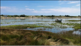
While the inland portion of the Town contains important wildlife habitat,significant vernal pools, and forested land, the Town’s most prominent natural resources are along its coastline and include the beach, dunes, the estuarine system associated with the Ogunquit River and the rock formations that can be seen from the Marginal Way.
Rather than an exhaustive list of all the natural resource features of Ogunquit, the following section highlights those considered to be of significance to both the community and the region. The section also outlines various organizations that contribute to managing these resources and makes note of some of the recreational opportunities afforded by the town’s natural spaces. Additionally, it presents regulatory measures the Town has taken, such as Shoreland Zoning Ordinances, and non-regulatory measures including educational outreach, to protect critical and important natural resources.
Wildlife and Plant Habitat
Two portions of Town, the northwestern area and the area around the Ogunquit River estuary and beach system, are mapped ‘Focus Areas of Statewide Ecological Significance’; a designation based on an unusually rich convergence of rare plant and animal occurrences, high value habitat,
and relatively intact natural landscapes (Map 1). The Focus Area Designation is intended to draw attention to places of special habitat in hopes of building awareness and garnering support for land conservation by landowners, municipalities, and local land trusts.
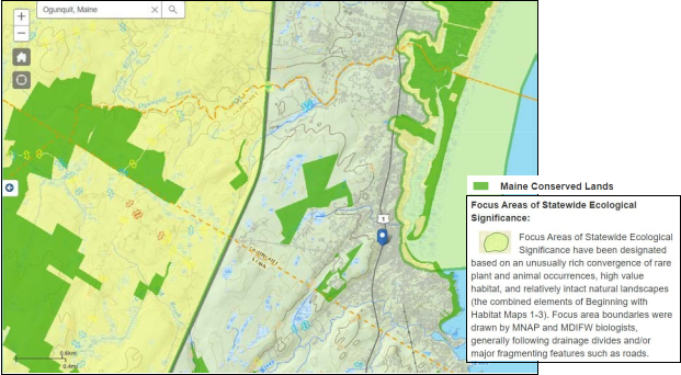
Map 1: Focus areas of statewide ecological significance and conserved lands in Ogunquit. Source: Beginning with Habitat
BwH’s “Plant and Habitats” map depicts a hierarchy of habitats and shows the mapped location of various species as well as their status under State and Federal wildlife protection programs. BwH maps illustrate a wide range of high-value plant and animal habitat present in Ogunquit. Large assemblages of rare plants and plant communities are found in and along the barrier beach system in Ogunquit. Ogunquit Beach and adjacent portions of the Ogunquit River are mapped coastal wetlands supporting shorebird habitat, including piping plovers and least tern; tidal waterfowl and wading bird habitat; and shellfish growing areas. There are wild brook trout priority areas (spawning areas) in and around Perkins Cove, Josias River, inland portions of the Ogunquit River and its tributaries, and coastline areas adjacent to the Marginal Way.
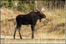
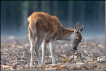
Large, relatively unbroken blocks of undeveloped habitat are present in Ogunquit, especially west of Interstate-95. These areas can support wildlife with large home ranges, such as moose, deer
and fishers, as opposed to suburban species such raccoons and skunks. Unfragmented blocks and connectors between blocks offer valuable opportunities to protect habitat connectivity and
preserve a wide range of species in a rapidly developing landscape, both locally and regionally. Implications for ecological health and wildlife diversity in the face of development pressure and sprawl in these locations may be an important planning concern for the Town.
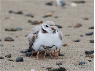
There are no mapped Great Ponds within Ogunquit, but there is considerable riparian habitat along wetland complexes within the Town and along the Josias and Ogunquit Rivers and their tributaries. Riparian habitats and buffers function as critical travel corridors for wildlife and contain 75% of all the species diversity in Maine. Several mapped significant vernal pools are within the town boundary, including one adjacent to an inlet of the Ogunquit River near the intersection of Route 1 and Captain Thomas Road, and clusters of
Piping Plover Photo: Matthew T. Rainey
pools in the northwestern portion of Town and the southwestern portion along the York border.
While Ogunquit has no lakes or ponds infested with invasive aquatics, the invasive green crab is present in tidal rivers and the shoreline. Ogunquit also has invasive vegetation, including bittersweet, knotweed and several others. Ongoing education and outreach about invasive species have increased citizen knowledge about the threats that invasives pose, but additional public education is needed.
Dunes and Shorelands
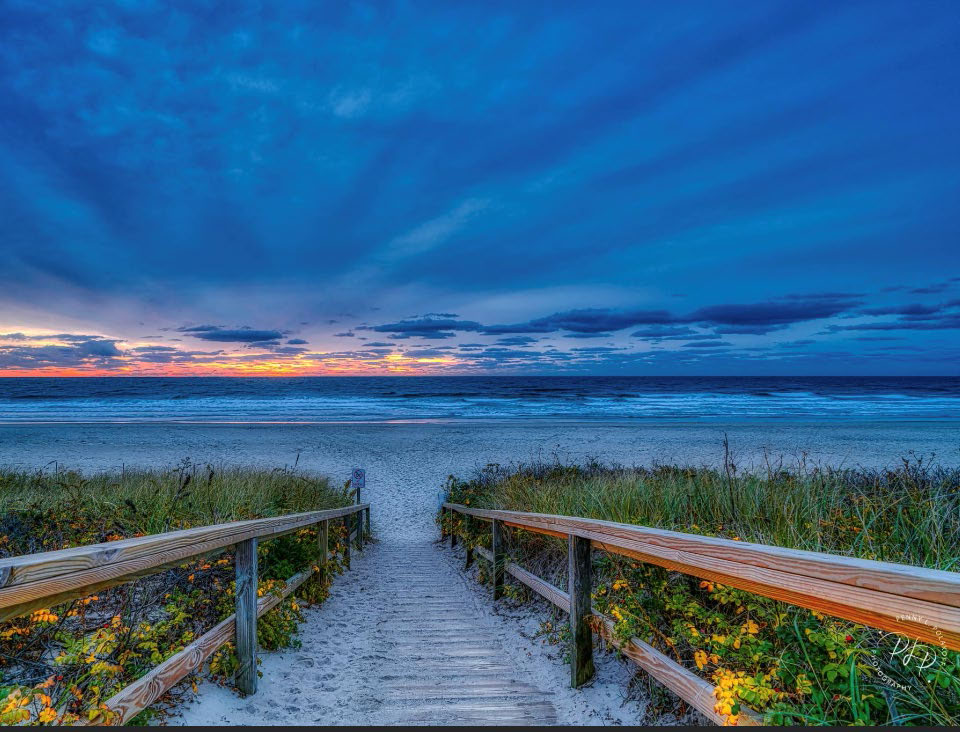
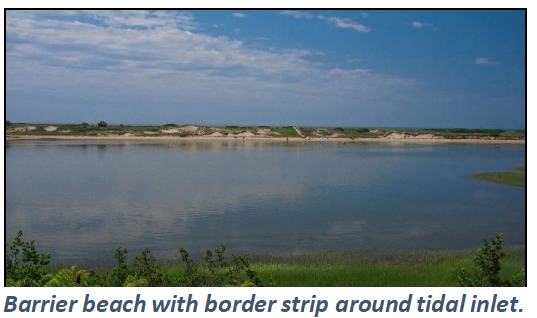
The Maine Geological Survey (MGS), through the State of Maine Beach Profiling Project and Maine Beach Mapping Program, conducts annual monitoring and profiling of Maine’s beach and dune systems. In its State of Maine’s Beaches in 2022 report, MGS noted
that Ogunquit Beach, in the short-term, experienced strong growth, or accretion, of its dune and beach; the mean dry beach width stayed about the same over the year. The report found that from 2020 to 2021, dry beach width decreased near the river and increased along most of the beach. The MGS report reveals that, over time, some areas of Ogunquit’s beaches are eroding
while some are accreting. Over the longer-term,
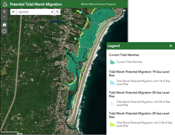
While sea level rise threatens inundation of the beach system, it can also facilitate the landward expansion, or migration, of tidal marshes. The Maine Natural Areas Program (MNAP) has mapped areas that could support marsh migration with future sea level rise. In Ogunquit, the backside of the barrier beach system and narrow strips along the Ogunquit River estuary have been identified as supporting future marsh migration.
Protecting these areas will be crucial for ensuring the long-term viability of local tidal marshes, which provide tremendous natural benefits and services including wildlife habitat, flood control, and water quality protection. (Map 2)
Coastline Resources: Marginal Way
Existing Conservation Lands
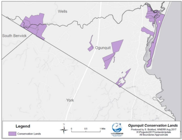
There are pockets of conserved land scattered throughout Ogunquit (Map 3). Conservation land is owned and managed by several different entities. The Town itself owns 250 acres of land, including the 142 acres of beach and land off Berwick Road which includes approximately 7 acres of conservation land.
GWRLT actively manages conserved lands within the community. The 22-acre Beach Plum Farm is a local treasure providing not only conservation value but a community garden. The Payeur Preserve and Kirkpatrick Woods provides 55 acres of protection for the Ogunquit River Watershed. More than half the Preserve abuts a 35-acre parcel, off Berwick Road, and is marked by stone walls surrounding the historic “Joe Maxwell Field,” including a double stone-walled cattle path. The land contains vernal pools and an open wetland meadow into the Leavitt Stream headwaters. The remainder of the Preserve is 20 acres of forested land just west of the Maine Turnpike and within Great Works’ Mt. Agamenticus Focus Area. This parcel contains the headwaters of Quarry Stream. Both Leavitt and Quarry streams are tributaries to the Ogunquit River. Plans include a possible wildlife-viewing platform in the meadow and augmenting the existing walking path beginning at the existing dog park, which is frequented by many community members. In addition, the Town owns 40 acres north of the Payeur Preserve, which is referred to as Bassett land.
Threats to Natural Resources
Scenic Vistas
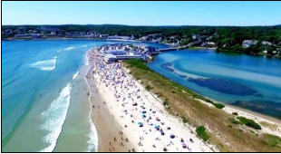
- OgunquitBeach is a 5-mile stretch of white sand and is consistently voted in the top 10 beaches in the US. Ogunquit has one of the best reliable surfing “breaks” at the mouth of the Ogunquit River on the east coast. There are three public access points to the main beach with parking and restrooms facilities.
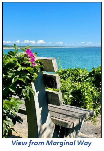
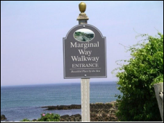
- TheMarginal Way, which was recently added to the National Historic Register, is a 25-mile paved cliff walk along the ocean from Perkins Cove to Shore Road close to the downtown area. Benches are available along the walking path. The Marginal Way Committee has an ongoing strategic program to remove invasive plants along the path and replace them with native plants. There is also a Town plan to ensure the safety of pedestrians using the path.
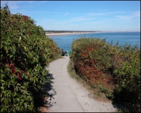
- BeachPlum Farm Nature Preserve contains community gardens and a half-mile loop trail leading to the Ogunquit River with a view of the dunes and the Atlantic
- Perkins Cove was originally a small fishingcommunity and art colony. Currently, the Cove is a quaint area that consists of shops, restaurants and scenic views and remains an active fishing harbor.
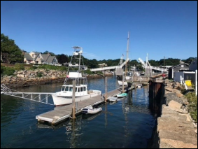
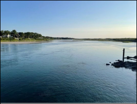
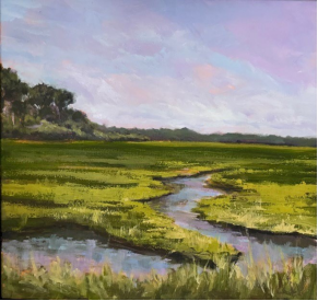
- The Ogunquit River is a 9.8- mile tidal river.It flows through the Town of Ogunquit and empties into the Atlantic The Ogunquit River watershed is rich in rare, diverse and endangered plant and animal species.
Goals, Policies and Strategies
Goal
- Wetlands;
- Shorelands,including the beaches and estuary;
- Sanddunes;
- Wildlifeand fisheries and marine life habitat;
- Uniquenatural areas including the Marginal Way; and conservation
Policies:
- Toprotect natural resources in the community including wetlands, beaches, sand dunes and wildlife and riparian wildlife
- Tocoordinate with neighboring communities, and state and regional agencies to protect shared critical natural resources.
- Toensure that the Town follows local shoreland zoning standards and regulatory measures to protect natural
Strategies:
- Priority: 1-5 with 1 being the highest priority.
| Description | Priority | Responsibility |
| Monitor, protect, and improve the water quality in natural resources areas such as beaches, wetlands, estuary, and wildlife habitats. Develop an action plan to address significant findings. | 1 | Town Manager |
| Analyze the health of the beach system (shoreland, dunes, and estuary) which is vital to the town. Report the results of the analysis to the public and develop a plan to ensure the health of the beach system. | 2 | Conservation Commission (ConCom) |
| Continue to protect endangered species such as the piping plover. Develop and distribute public information materials. | 3 | ConCom |
| Establish a plan to limit/eliminate the spread of invasive plants on Town land and public access ways, then replant those areas with native plants in conjunction with the Marginal Way Committee. Educate and work with landowners to prevent the spread of invasive plants. | 4 | Con Com |
| Create a Natural Resources Manager position. | 5 | Town Manager |
| Encourage public/private partnerships to protect natural resources with our partner organizations. The Marginal Way Committee and the Marginal Way Preservation Fund are an example of a public/private partnership. | Town Manager | |
| Increase annual contributions to the Town’s Conservation Land Acquisition Fund to purchase undeveloped parcels that will remain as green space. Add to the Town budget to be voted on by residents. | Select Board | |
| Make information available to those living in or near critical natural resources such as the Shoreland Zones about current tax programs and applicable local, state, or federal regulations. | Town Treasurer | |
| Ensure that all Town land use Ordinances are consistent with Town, State, and federal laws regarding critical natural resources. | CEO | |
| Designate critical natural resources as Critical Resource Areas as provided in the Future Land Use Plan. | ConCom | |
| Continue to monitor subdivisions and developments to identify critical natural resources that may be on site and take appropriate measures to protect those resources, through Town land use ordinances. This may include erosion and sedimentation control, use of native plants, and tree replacement where warranted. | CEO | |
| Continue to require the Planning Board to include, as part of the review process, consideration of pertinent Beginning with Habitat (BwH) maps and information regarding critical natural resources through Town ordinances. | Planning Board | |
| Participate in regional planning with organizations such as Ogunquit River Watershed Steering Committee, Maine Department of Environmental Protection (DEP), Maine DEP Healthy Beaches, SMPDC, Ogunquit Sewer District, and Army Corps of Engineers around shared critical and important natural resources and water quality issues. | Town Manager | |
| Develop, distribute, and make available on the Town website a guide/pamphlet describing all of Ogunquit’s natural resources. | ConCom | |
| Seek new grants to strengthen and provide resilience to coastline, including the beach, estuary, Marginal Way and Perkins Cove. | Town Manager |